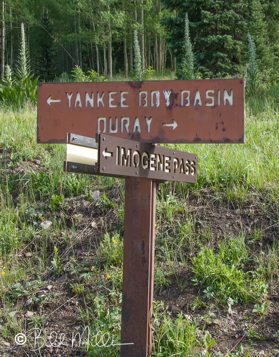
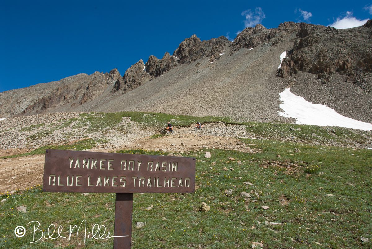
Yankee Boy Basin is a destination, but it also refers to a nearby old gold and silver mine from the late 1800’s, part of the Colorado mining boom at that time. The term “Yankee Boy” is thought to refer to a group of miners or settlers from the eastern United States, specifically New England, who flocked to the area to seek fortune. Today, off-road enthusiasts, hikers, photographers, and others are drawn to the area for its rugged beauty and opportunities to immerse themselves in the natural surroundings. The trail to the basin is composed of a continuous route with two named sections: Camp Bird Road (Ouray 361 County) right out of Ouray, turning into Yankee Boy Basin Rd (County 26). While the gravel road is easy, the elevation climbs all the way. The last mile, however, is steep, narrow, and “adventurous”! This part of the trail is marked by a seasonal gate and parking area.
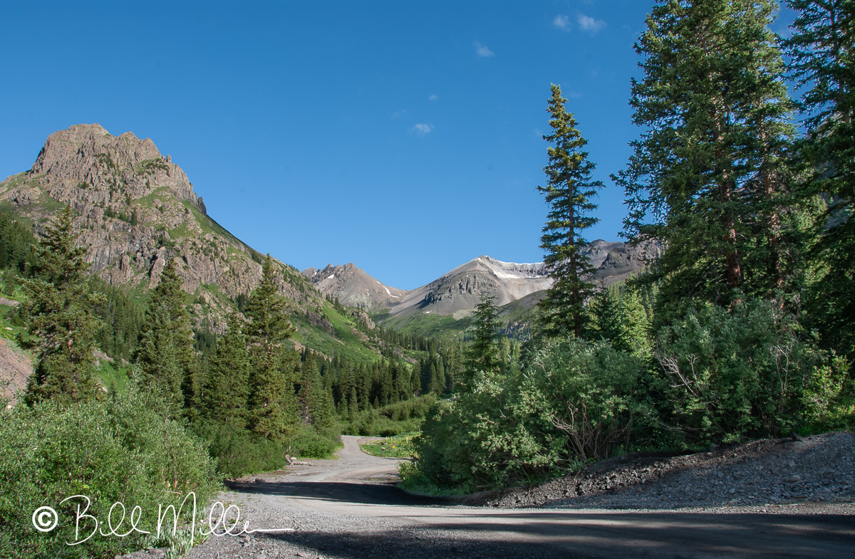
The basin itself ranges from 11,000 – 12,000 feet in elevation and is surrounded by steep mountains, creating a bowl-like shape. It collects snowmelt and rainwater creating small lakes, or feeding directly into streams that are seen on the drive. One steep mountain is Mt. Sneffels, reaching 14,197 feet. A popular, moderately difficult climb to the summit has an elevation gain of almost 3,000 feet and a roundtrip distance of 5.5 miles requiring 5-7 hours. The standard route involves scrambling over deep scree.
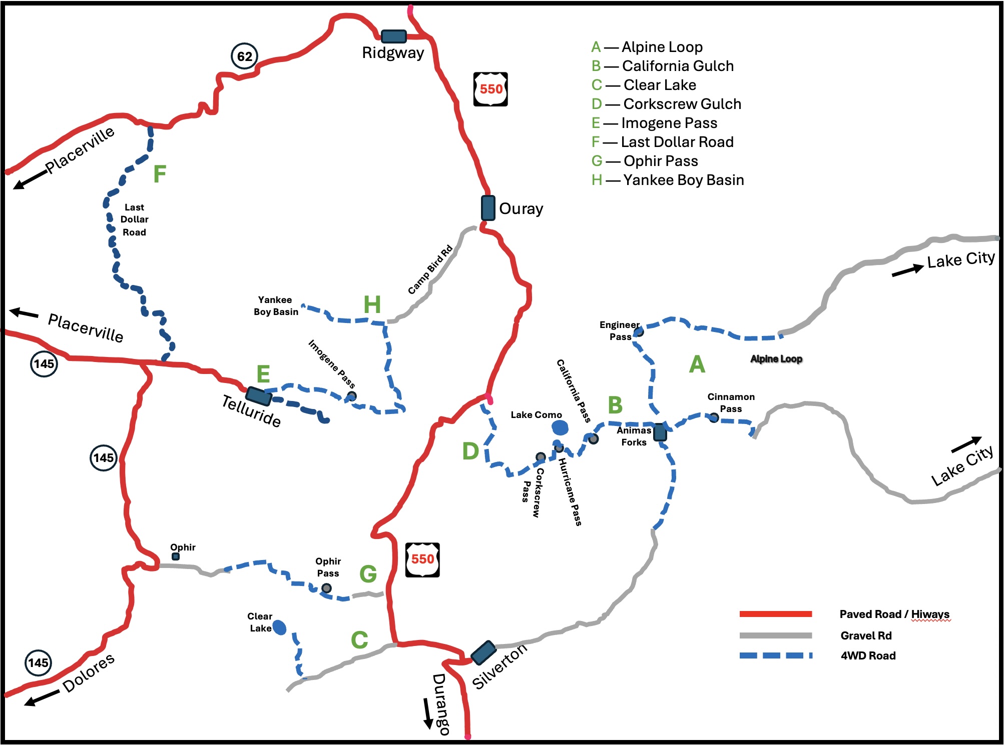
Map of the Ouray-based trails.